Sapa
Located some 380 kilometers northwest of Hanoi, the town of Sapa perches at 1,560 meters above sea level at the foot of Mount Fansipan, the highest mountain in Vietnam. And so, it is no surprise that Sapa has earned its reputation as the "Town in the Clouds." Early in the twentieth century, Sapa became a popular tourist resort for those seeking a cooler climate. The town is renowned for this quality, just as it is for changeable weather. In the morning, thick mist shrouds the town, by noon Sapa can be as clear and sunny as a summer afternoon. However, by afternoon, the crispness of autumn creeps in, and, by nightfall, cold air from the mountaintop sweeps into town, possibly even bringing a light shower of snow. Sapa's average annual temperature ranges from between 15 to 18°C, although in winter temperatures can drop as low as zero degrees. The town experiences heavy rainfall from May to August.
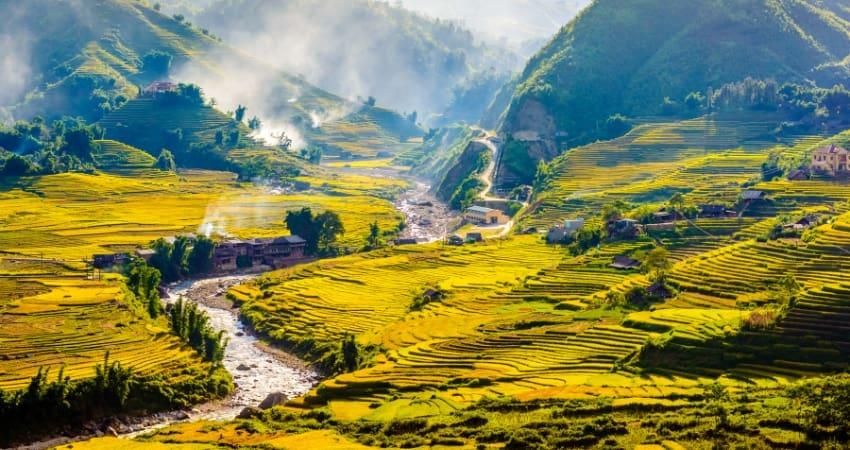
Sapa is attractively positioned, with the Hoang Lien Son Mountain Range to its west and sights such as the Ham Rong (Dragon's Jaw) Mountain, May (Rattan) Bridge, Heaven's Gate Stone Formation, and the Silver Waterfall within easy reach. The French built the town as a convalescent site. Its center is reminiscent of a quaint European village with over 200 French villas, lush green vegetation, and peach blossoms. Today, some of its villas bear names such as "Rose," "Carnation," and "Pearl."
Fruits and flowers are abundant almost all year. round in Sapa. Spring brings pear and peach blossoms, and by summer the peaches and plums are abundant along with pansies, sunflowers, and gladioli in full bloom. Residents harvest apples and pears in the cooler months.
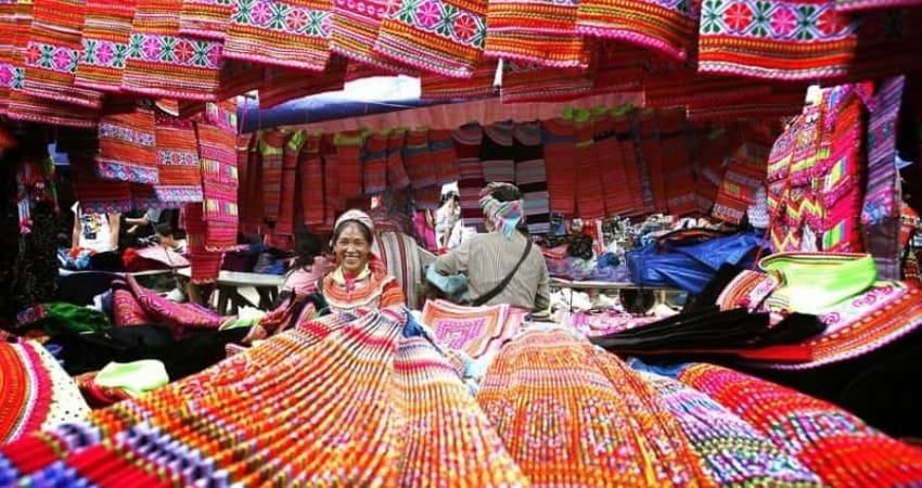
A Sapa highlight is its local market, where people from different ethnic-minority groups gather to display their wares. Sapa District has a population of 30,000, of which the H'Mong ethnic group accounts for 53% and the Dao for 30%, followed by the Kinh (ethnic Vietnamese), Giay, Tay, Kho Mu, and Phu La groups. Every Sunday, the Sapa Market becomes a colorful place for cultural and economic exchange. People travel from hamlets as far as fifty kilometers away to buy and exchange products. The market is a cornucopia of grains, fresh fruits and vegetables, fabrics, brocades, embroideries, meats, salt, sugar, candy, medicinal herbs, and bracelets.
Market day is a festival of colors because ethnic-minority people wear their best clothes when they come to town. The Dao people are particularly noted for their colorful dress, and the Red Dao often wears large-brimmed hats with detailed embroidery and tintinnabula. On festive occasions, the Phu La people wear clothes with intricate, embroidered patterns and dance their swing style. They sometimes play còn, where they toss about a ball made of cloth with decorative fringes in the hopes of finding a suitable marriage partner.
Every Saturday evening, residents organize a long-held tradition, the "love market." Young people from different ethnic groups particularly the H’Mong, Dao, Tay, and Kho Mu -gather to exchange gestures of love through song and music. By twilight, youth crowd the market, sitting, chatting, and singing as they look for a partner. Often the Dao youth exchange souvenirs, usually a handkerchief, to display their mutual affection as they make promises to meet again at the next Saturday market.
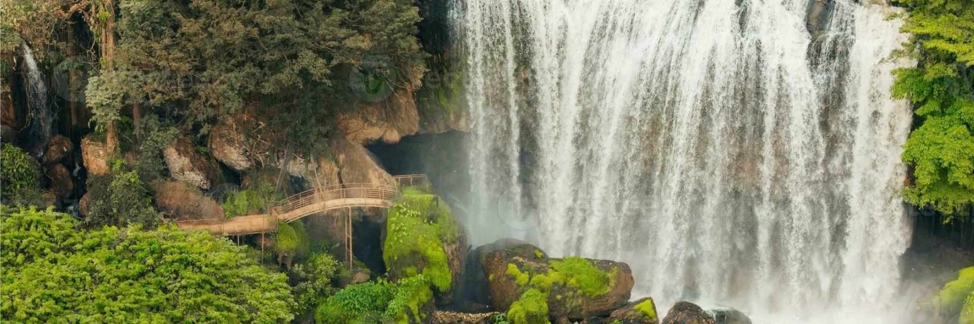
A popular day trip is to the Silver Waterfall, which is just twelve kilometers from Sapa. As its name indicates, a constant silver mist shrouds the waterfall, which is a hundred meters high. The waterfall is particularly plentiful following heavy rain. Further, it is conveniently near the road to Lai Chau. Worth visiting is Muong Hoa Village, which is only five hundred meters from the waterfall. Here, visitors can cross a traditional suspension bridge (Cau May, literally, "Cloudy Bridge") made of rattan rope and supported by a huge tree. The experience is unique for visitors since clouds often cover the bridge as they make their way across the winding Muong Hoa River.
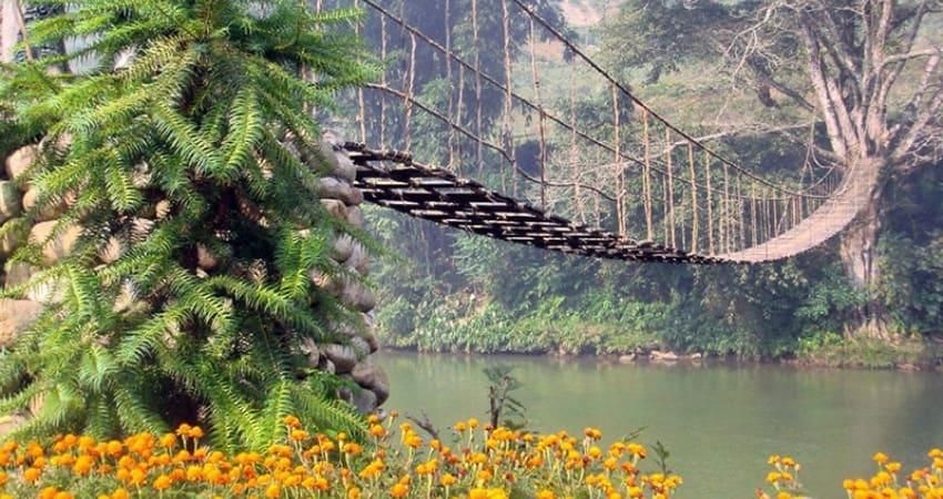
The mountain on the other end of the bridge has a rock formation said to resemble a tiger ready to jump its prey. On the far side of the mountain is an abundance of wild orchids. Five to six kilometers southeast of Sapa is Heaven's Gate, an area with over two hundred engraved stones. Archaeologists first noticed this area in 1925; UNESCO is considering it for recognition as a world heritage site. The stones have motifs and figures, including a stilt house, and bear such names as "Father Stone," "Mother Stone," "Saddle Stone," and "Mill Stone." The "Father Stone" is fifteen meters long and six meters high.
Mount Fansipan
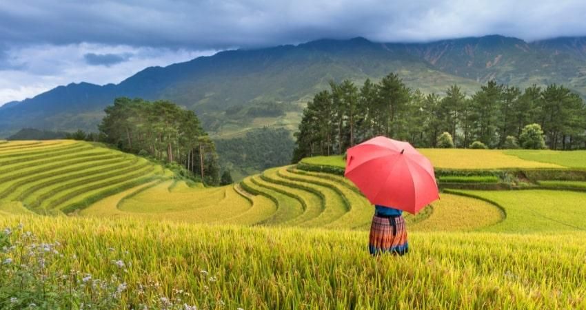
Mount Fansipan, Indochina's highest mountain at 3,142 meters, is located in Lao Cai Province and presides over the Hoang Lien Son Nature Reserve. Vietnam's loftiest peak is quite accessible, requiring five to seven days to reach the summit, starting from and finishing in Hanoi. The climb itself starts in the valley separating the mountain from Sapa, a popular tourist destination. The path moves through a picturesque landscape of steeply terraced rice paddies cultivated by the Black H'Mong and other hill ethnic-minority groups. Leaving villages and farms behind, the route rapidly gains elevation and enters a forest that grows on precipitous granite slopes.

A unique assemblage of plants and animals lives here at Vietnam's highest altitude. The tropic and temperate realms meet here, where the Himalayas taper to their easternmost terminus. These high peaks support life forms found in no other place on the planet. During the past decade, scientists have found dozens of new species known only in the area of Mount Fansipan.
Interesting bird species found nowhere else in Vietnam include the rare and endangered beautiful nuthatch, which lives in the cypress forests of the equally rare and endangered po mu tree. Po mu trees once dominated the Fansipan slopes, but their value as timber led to over-exploitation and rapid decline. Long-term protection of the range's last po mu grove is part of conservation initiatives sponsored by Fauna & Flora International (FFI), which hopes to help Vietnam protect the cultural and biological diversity of the Hoang Lien Son Range as a “Man and Biosphere Reserve."
Muong Hoa (Flower Hamlet) appears at 2,500 meters after a trek up steep gullies through Pansipan's mountain forests. This ridge is clad in an "elfin forest," so named because of its gnarled and twisted dwarf rhododendrons in a landscape overflowing with mosses, lichens, and orchids. This mystical forest would be a suitable habitat for elves from a Tolkien fantasy. The rock outcrop on Muong Hoa offers a view of Sa Pa and the intervening valley. The path then enters a forest composed of bamboo. The last two hundred meters to the summit is the highest place in all of mainland Southeast Asia outside of distant Burma.
Cat Ba Island
Located thirty miles from the town of Hai Phong, Cat Ba Island is famous for its romantic karst seascape, with towers rising steeply from the sea. Some visitors find it even more beautiful than neighboring Ha Long Bay. Its national park is home to a diverse, endemic forest flora and one of the world's most endangered primates, the golden-headed langur. Cat Ba is a perfect place to relax, and it's less than three hours from Hanoi.
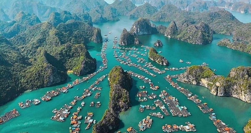
Visitors stepping off the boats find themselves in Cat Ba Town nestled around a bay filled with colorful fishing boats. Friendly hotels and restaurants border the promenade. The first afternoon is best spent admiring the landscape at Cat Ba Beach. For dinner, try Xuan Hong, a floating restaurant next to Beo Harbour, since it serves the best seafood in town.
To see the golden-headed langur, talk to Mr. Phung at Beo Harbour. Silent and patient observation with the aid of binoculars at 5:00 A.M. may pay off handsomely with the sight of a langur troop feeding on a cliff face seventy meters high. However, getting there requires a three-hour trip. Extending the journey into a day trip around Lan Ha Bay brings the reward of seeing spectacular karst gorges and towers, with small, secluded beaches alongside turquoise water.

Hotels in town can book a tour of the national park, including a forest trek and a stop at the Trung Trang Caves. The most demanding and spectacular day trek leads past Frog Lake, which is surrounded by swamp forests, and continues through primary forests to the fishing village of Viet Hai with a return trip by boat to Cat Ba.
Another possibility is to hire a motorbike for VND 80,000 (US$ 5) per day and visit the national park headquarters. From there, Frog Lake is a short trek. Or climb Ngu Lam Peak with its fantastic overview of the karst landscape and forest ecosystems; the short climb requires only one hour for a roundtrip. A further drive to Phù Long will likely include sightings of shorebirds in the mangrove forests and mudflats or near Kim Cương Cave on Cat Ba Island.
Cuc Phuong National Park
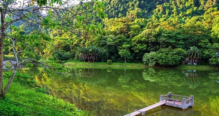
Located a hundred kilometers southwest of Hanoi, Cuc Phuong National Park (Ninh Binh Province) is in the easternmost part of a limestone range emanating from the Son La Plateau in northern Vietnam. Cuc Phuong is a globally important example of a terrestrial karst ecosystem and the only remaining large area of lowland and limestone forest in northern Vietnam. Just two hours south of Hanoi, large shadows of the first karst towers interrupt the reflections from the rice fields, signaling Cuc Phuong's proximity.
In millions, the spring of white and yellow migrating butterflies surround visitors as soon as they enter the park. The eco-tourist destination should always be the Primate Rescue Centre and a conversation with staff members about their efforts to rescue Vietnam's most fascinating primates from the wildlife trade. Extinction threatens most langurs and gibbons; Cuc Phuong is the only place to see them without spending weeks in the forests. Gibbons call from a fenced hill. Across the path, Fauna & Flora International (FFI) and Education for Nature - Vietnam (ENV), a Vietnamese non - governmental organization, have project offices to help the national park develop Vietnam's first park center for visitors. Staff members there will introduce visitors to Cuc Phuong’s unique karst ecosystems, including fauna and flora.
In the afternoon, visitors can take a walk on a marked, two-hour trail to see Cuc Phuong’s giant trees in a rare stand of primary tropical forest. An incredible diversity of trees, lianas, and ferns overgrows the karsts. An important archaeological site, which was the home of early man, is also home to seventeen species of bats. Visitors can watch endangered Owston's palm civets, which are nocturnal, search for insects in their spacious enclosure at FIFI's small civet conservation facility. Some have successfully bred in captivity. It is a special pleasure to watch baby civets.
Visitors who stay overnight can go birding in the morning chill at 6 A.M. and might see bar-
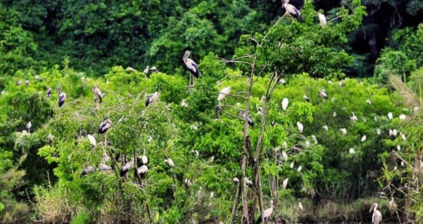
bellied Pitta birds and trogons just beyond the park gates. Silver pheasants and jungle fowl are plentiful. On the way home, travelers can turn left to visit Van Long, a small limestone outcrop surrounded by a wetland just before the junction with Highway 1. Local villagers will row visitors in small boats so that they can come close to the rock. In addition, they can see Delacour's langurs, a critically endangered primate endemic to the Cuc Phuong - Pu Luong Limestone Range. Protected by local people, the langurs cavort in the late afternoon as tourists watch.
Pu Mat National Park
Located in Nghe An Province, Pu Mat National Park is the flagship park on the northern massif of the Truong Son Mountains along the Vietnamese-Lao border. The area contains some of the world's most threatened species. Here, in these steep forested mountain slopes of the Vu Quang Nature Reserve and the neighboring protected area of Pu Mat National Park, a team of Vietnamese discovered a new genus of large mammal, the sao World Wildlife Fund (WWF) scientists recently the sao la (Pseudoryx nghetinhensis).
Visitors taking Highway 7 from coastal Vinh beauty towards the border. The park headquarters to Pu Mat meanders west through pure, rustic areas near Con Cuông, a small "wild west" town perched on the banks of the huge and slumbering Ca River, which is itself nestled amongst precipitous karst peaks.
Pu Mat’s true wilderness with spectacular features such as the Kem Waterfall accessible only to well-organized expeditions. However, the reachable buffer zone shares the park's beauty. Park staff can direct visitors traveling on foot or by motorbike to ethnic Thai or Dan Lai (Tho) villages and can even help arrange for stays in the villagers' stilt houses in the luscious, forested river valleys. Here, visitors can experience the park's extraordinary diversity, although they won't glimpse the more magnificent wild animals, such as Asian elephants, tigers, sao la, Asian black bears, or yellow-cheeked gibbons.
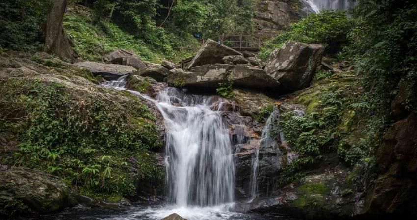
Those who stop to rest or swim in the shimmering rivers may glimpse rare, giant black squirrels jumping through the forest canopy and hear the crested argus, a beautiful pheasant with one of the world's longest sets of tail feathers. The buffer zone is to see local people living together in a perfect place with the forest. Elderly Thái women search for gold, using sticks to balance themselves on wooden water wheels to irrigate their small rivers. Young men and women build large fields. Local villagers will guide visitors through labyrinths of karst caves during nighttime bat surveys. Many caves are over ten kilometers long. Surveys have shown that these caves may contain the greatest diversity of bat species in Vietnam.
Habitat destruction and hunting threaten the park's animals and plants, which deserve the highest global priority for conservation. The Pù Mát National Park staff is working hard to save this jewel for future generations.
Bach Ma National Park
Bach Ma National Park (Thua Thien Hue Province) protects a unique natural forest stretching from the Eastern Sea to the Vietnamese-Lao border. Located at the end of the North Truong Son Mountain Range, Bach Ma's tallest mountain peak is 1,450 meters high. Other mountains over 1,000 meters include Nom (1,259 meters) and Truoi (1,154 meters). Long, narrow valleys with complex stream and river systems surround the large system of salt-water lakes and lagoons mountains. The eastern part of the national park offers scenic splendors.
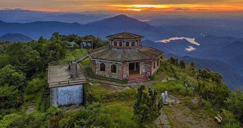
During the 1930s, the French used the site for a resort, which had 139 villas, a swimming pool, tennis courts, a market, a post office, and a road system connecting the mountain range to Highway 1. Today, Bach Ma remains an ideal holiday resort, thanks to its natural beauty and a cool climate with summer temperatures between 18 and 230C. The park has Vietnam's highest rainfall, nearly eight meters annually.
Bach Ma National Park boasts a wide range of biodiversity, including species endemic to both northern and southern Vietnam. It has 1,406 recorded plant species, of which thirty are listed in Vietnam's Red Book. And even several species new to science, such as Elaeocarpus Bachmann and Cissus Bachmann.
The park also has diverse fauna: eighty-three large mammal species from twenty-three families and nine orders. Among the species, sixty-eight appear in Vietnam's Red Book, including the sao la (Pseudoryx nghetinhensis), Vu Quang muntjac deer (Megamuntiacus ), Truong Son muntjac (Muntiacus Truong Sinensis), and the white-cheeked gibbon (Hylobates Gabrielle). Other animal species include birds (333 species), amphibians (21), reptiles (31), fish (39), butterflies (256), beetles (178), and termites (28). Data on small mammals are still incomplete.
Surveys conducted have shown that Bach Ma has an especially diverse array of bat species compared with other Vietnamese reserves, with fifty-nine species recorded plus some other unidentified specimens. Eight of its species appear in Vietnam's Red Book 2000, and five are listed in the IUCN (International Union for Conservation of Nature and Natural Resources) Red List of Threatened Animals 2.000. Among these species, the long sella horseshoe bat (Rhinolophus parasaurolophus) only has five known populations, with at most only between 150 to 250 bats per population. Captured bats include a Thai evening bat (Thainycteris aureocollaris), recorded only for the second time in Vietnam. Scientists first recorded this species in 1999 in southern Vietnam. Other species include the Old World fruit bat family (Pteropodidae) belonging to the suborder Megachiroptera. The Bach Ma fruit bats (with ten species and seven genera belonging to this family) have the most diverse species composition compared with those found in Vietnam's other national parks and nature reserves.
With its advantages in biodiversity and natural beauty, Bach Ma is becoming an important eco-tourist destination in central Vietnam.


